


 100 / 125

100
Maps
1153
The Countie of Westmorland and Kendale
the chief towne, hand coloured map
marked John Speed 1743 Anne 56 x 43 cm
£25 - £30
1154
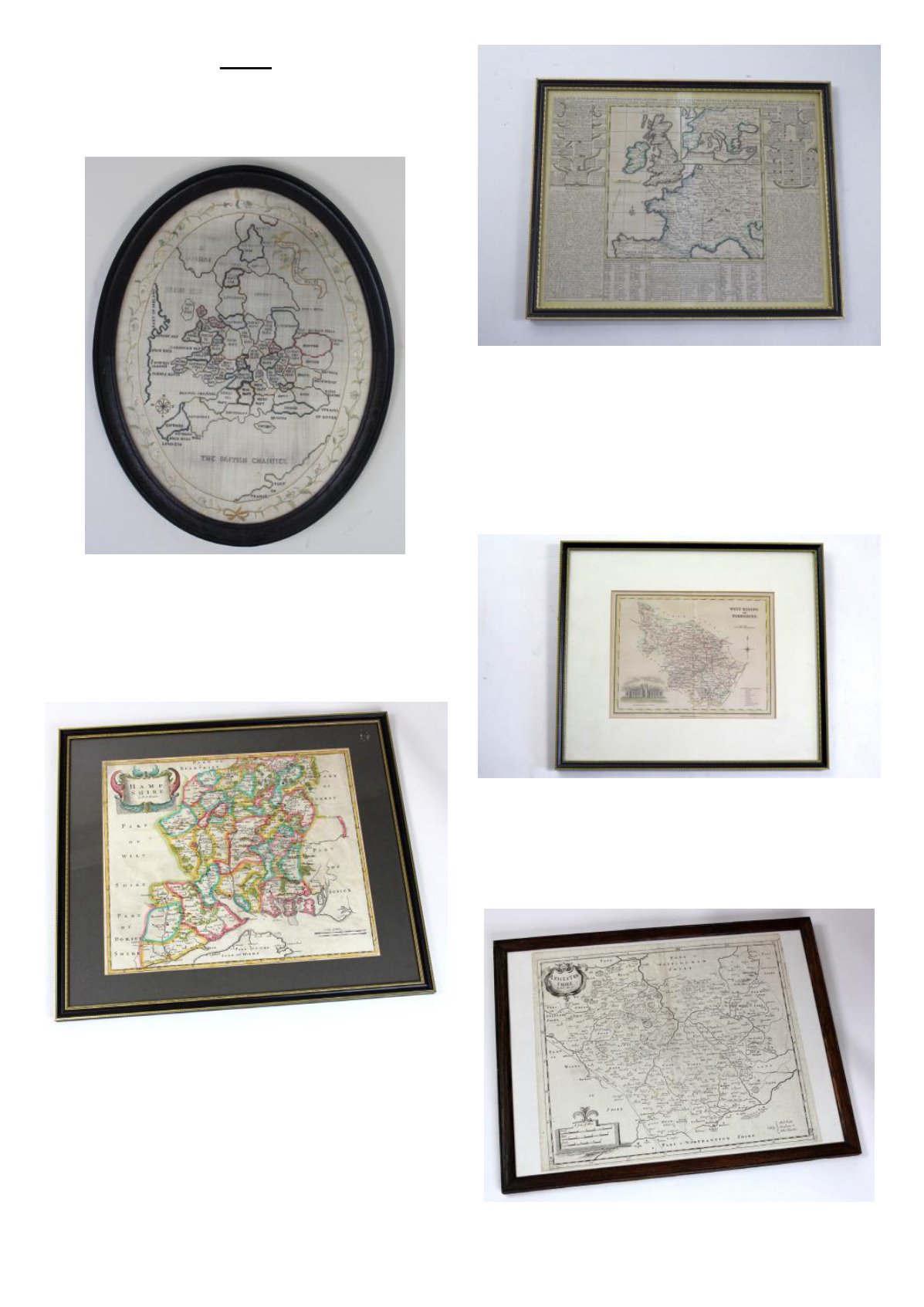
Early 19th century Map Sampler depicting
the British Isles in a period oval frame and
embroidered with a foliate border
£150 - £180
1155
Mounted, glazed and in an ebonized
frame a map of Suffolk by Eman Bowen,
Geographer to His Majesty, frame size
approx. 2' 5" by 3'
£80 - £120
1156
Framed map of Hampshire by Rob
Morden, coloured. Visible size h.37cm x
42.5cm.
£60 - £80
1157
Map, Imperial Assemblage "Delhi" 1st
January 1877, general map showing
posistions of the camps. dated at the
bottom November 1876
£40 - £60
1158
Hand coloured map "The north riding of
yorkshire" marked R .Morden 1688 James
II
£15 - £20
1159
Hand coloured map of Britain and France,
in french marked Chatecain and 1672
Charles II
£30 - £40
1160
Exquisite hand coloured map of Artesia in
latin and marked to the reverse 1620 P
Kearius and measuring 52 x 42 cm
£25 - £30
1161
A new and accurate description of all the
roads in England andWales 5th edition by
Patterson 1781
£40 - £60
1162
19th century hand coloured and engraved
map depicting the west riding of
yorkshire featuring wakefield school
£20 - £40
1163
Large hand coloured map showing part of
Lancashire marked Emanuel Bowen 1760
George III
£20 - £25
1164
Framed map of Leicestershire by Rob
Morden. Size h.37.5cm x w.43.5.
£40 - £60